Getting there
According to Google Maps, it would take 5.5 hours to drive from Edinburgh to Portree in Skye. Relying on public transport it took a little longer than that for us, taking all day to get to Kyle of Lochalsh and then a bus in the morning to finish off the trip – call it a day and a half all up.
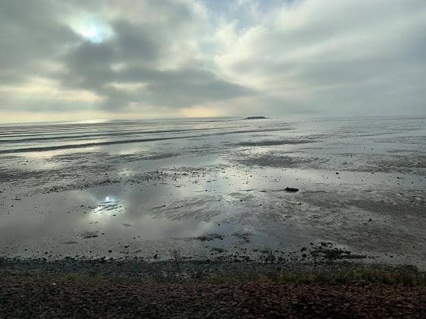
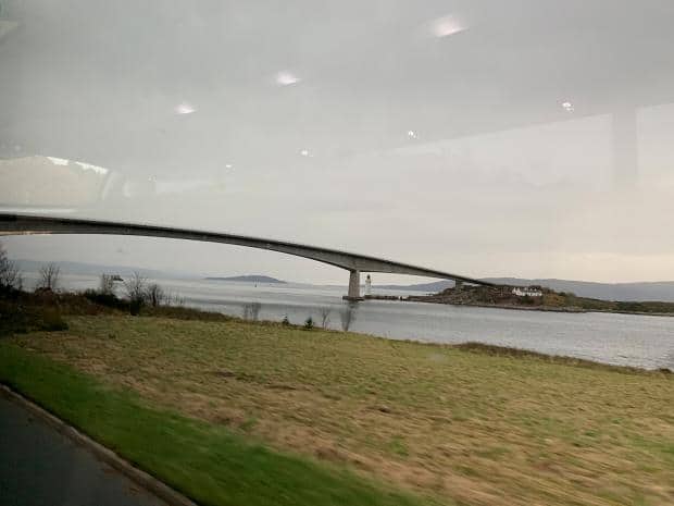
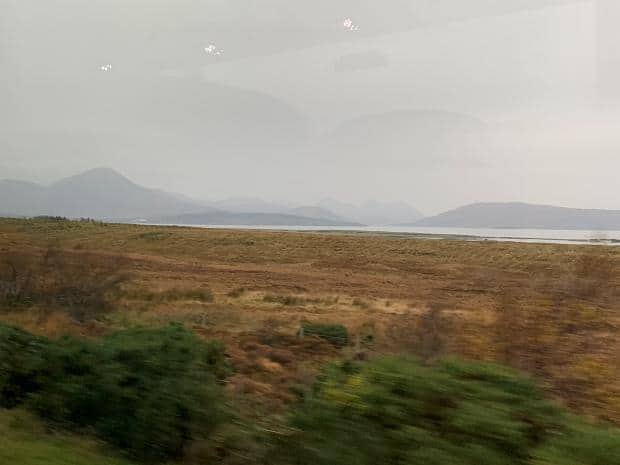
It wasn’t all bad though, some of the views from the train being quite stunning.
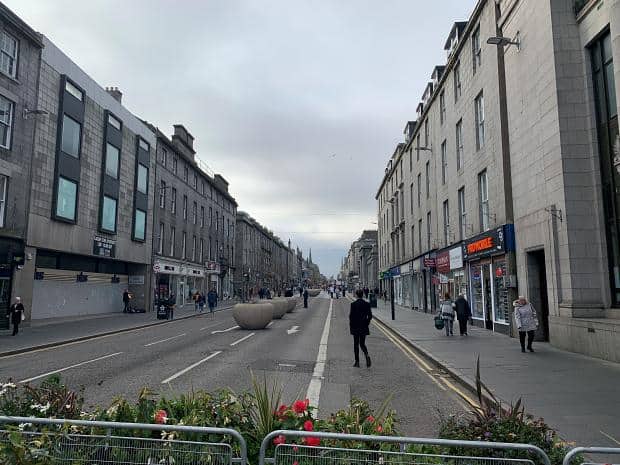
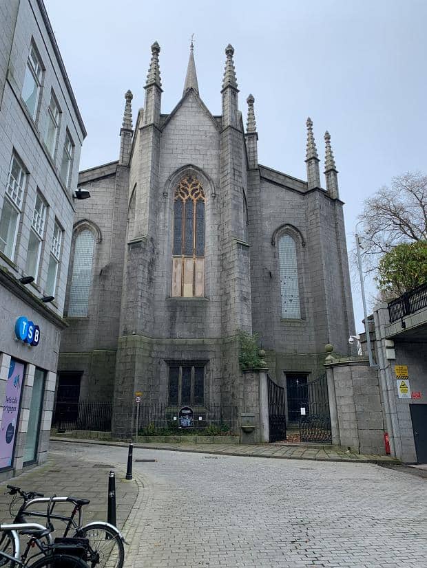
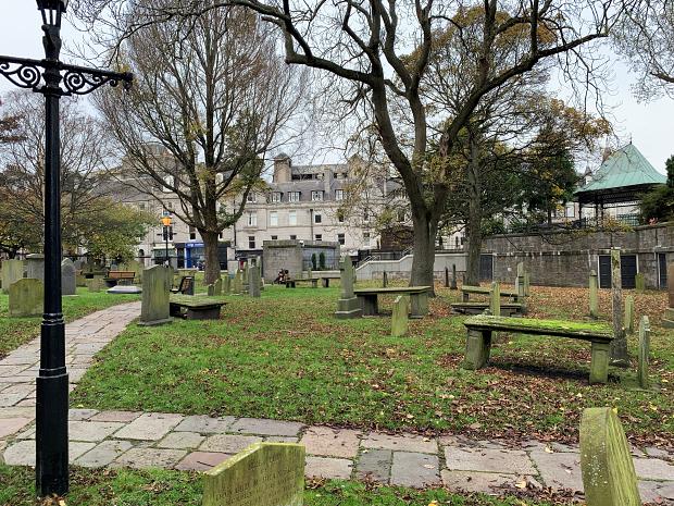
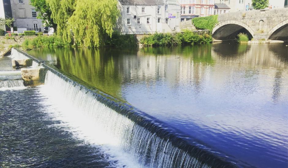
Aberdeen
One of the reasons it took so long to get to Portree was that the schedules of each of the component legs just didn’t marry up. Given the gaps, we elected to have a look around Aberdeen town centre.
Inverness
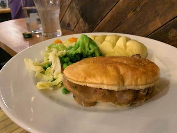
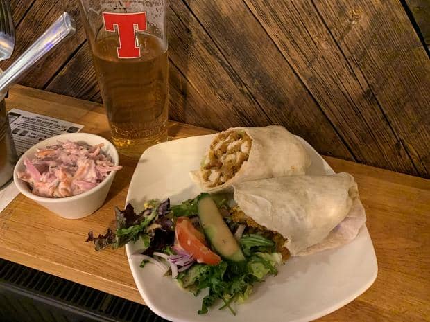
With an hour in Inverness we elected to have a meal at the Belhaven Pub near the station to ensure we weren’t late for the train departure.
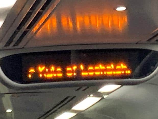
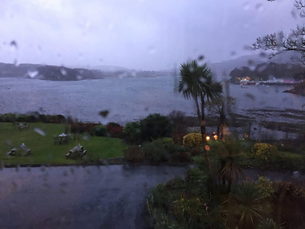
Overnight at The Kyle
And then we were within eyeshot of the Isle of Skye. We elected to stay overnight at The Kyle Hotel where I’d stayed with Mum 9 years previously when we’d visited the Isle of Skye.
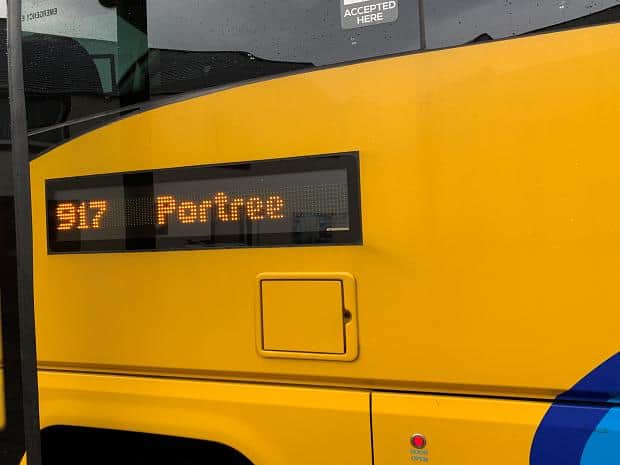
Bus to Portree
The train line finishes at Kyle, so we took the bus to Portree instead.
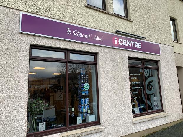
Portree
The biggest town on Skye is Portree, home to a couple of Co-op supermarkets, the only ones on the island. A network of local bus routes sporadically run allowing the locals to go shopping, the bus stop outside the larger of the supermarkets visited by each of the buses we took.
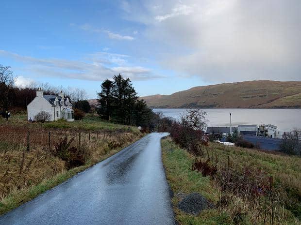
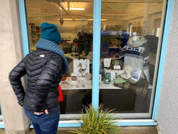
Cuillin Hills Hotel
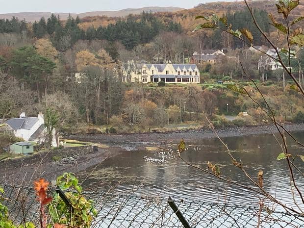
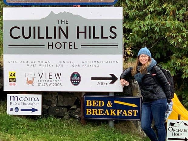
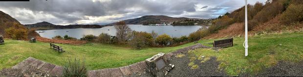
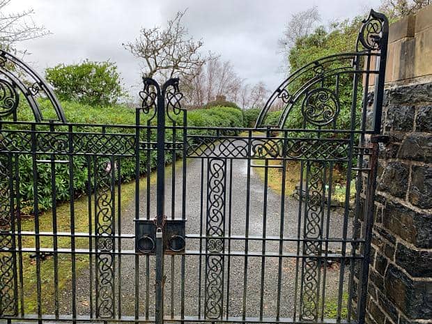
The Cuillin Hills Hotel where we’d booked to stay for the week was around a 13 minute (according to Google) walk from the centre of town, visible across the harbour from the main road.
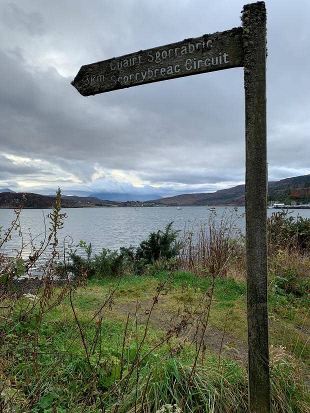
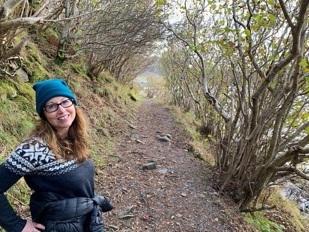
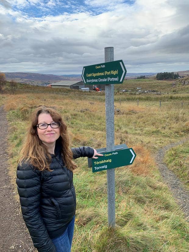
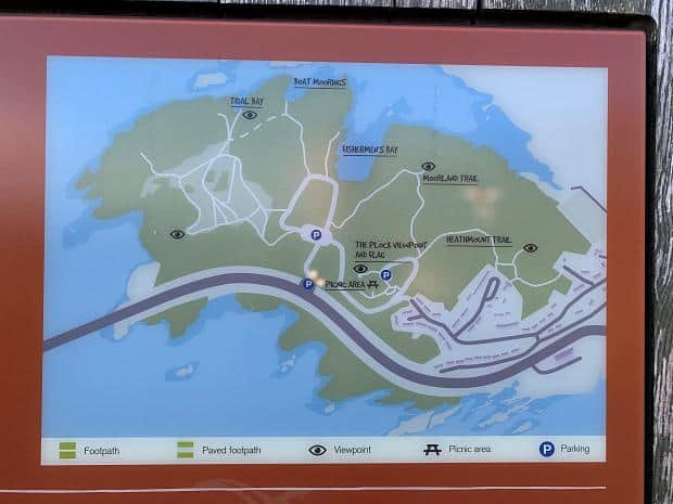
Scorrybreac Circuit
On the first day we decided to do the Scorrybreac Circuit, the start of which we’d passed on the way to the hotel.
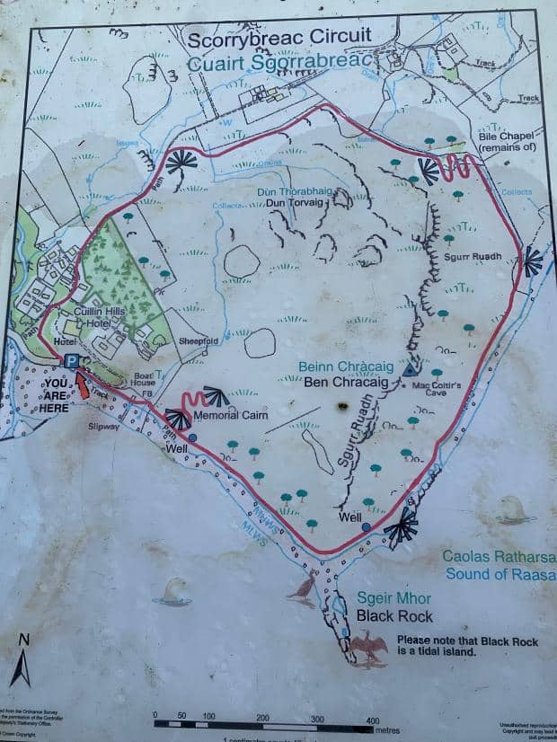
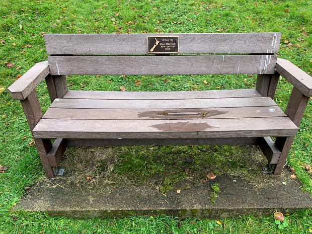
We were about to pass the large park-like clearance on our left when I glimpsed a map of New Zealand on the park bench so we had to investigate.
It turns out that the Scorrybreac Circuit runs through the headlands which were the family homestead of the Nicholson family, and the park bench in question was donated by the Nichols clan in New Zealand.
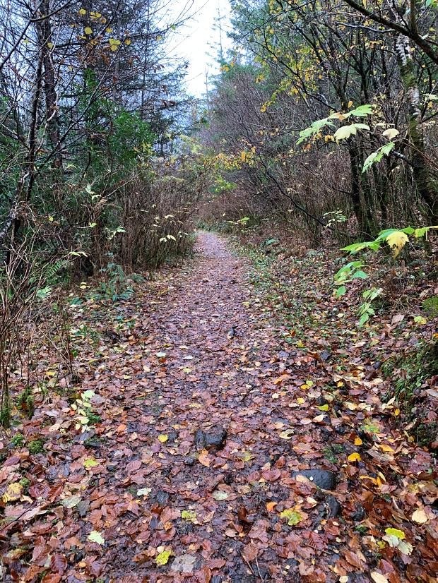
The path meandered pleasantly along the waters edge, the branches of the trees meeting above the trail making a nice canopy. The path wasn’t too muddy and we made good time.
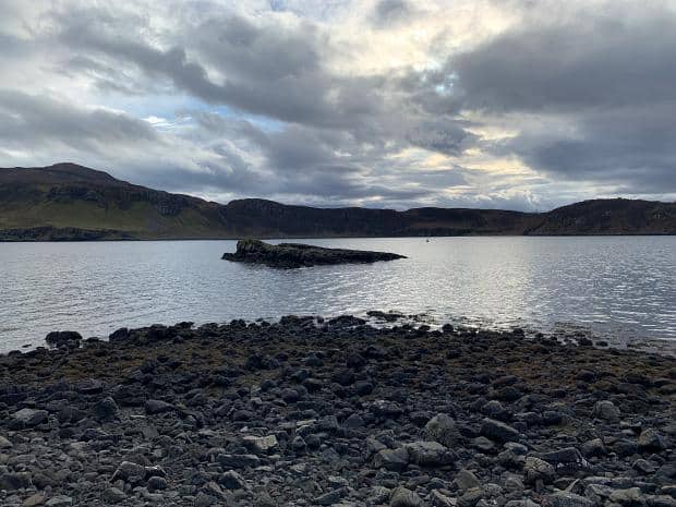
The tide had come in enough to separate the Black Island from the mainland. It turned out that Bonnie Prince Charlie had left from this point dressed as a woman in his return to France after the disastrous battle at Culloden.
Around the corner the path became a little more challenging, gaining elevation and becoming a little more muddy. Looming above us to the left were cliffs with sea hawks apparently nesting in the cliffs. We saw some wide winged birds staying aloft without flapping their wings – surfing the updrafts – but I wasn’t sure whether they were sea hawks or some other species.
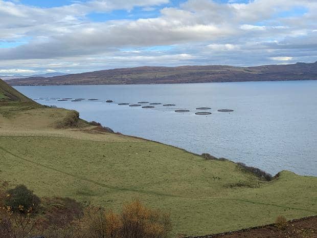
As the path turned inland, it started to switch back onto itself as it climbed steeply up the hill to a lookout high above the sea. Below we could make out one of the many salmon farms offshore, and a different path split off the Circuit and headed out over the neighbouring farmland past sheep and cows beyond the hills further along the coast.
We paused on the park bench overlooking the vista for lunch and to say hi to a couple walking their dog, and then continued along the path. It was much less steep and eventually left the overgrowth into farmland on the back of the path.
Though it was only a warm up, the steepness of the hill reminded me of how unfit I was. Ange had made the comment that even though she couldn’t see me on the steepest part of the hill track through the trees and undergrowth, she could still hear me ahead of her because of the wheezing and puffing. Hmph!
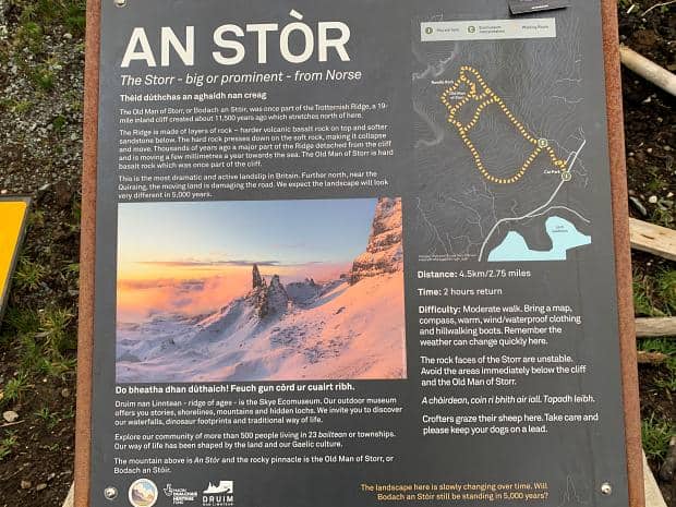
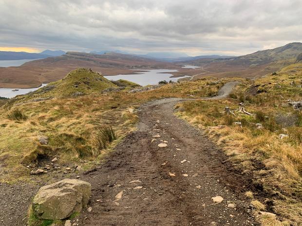
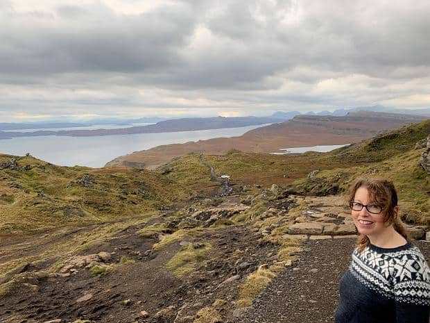
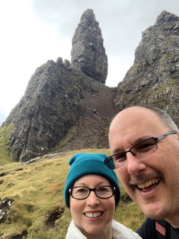
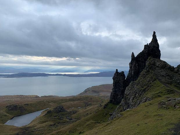
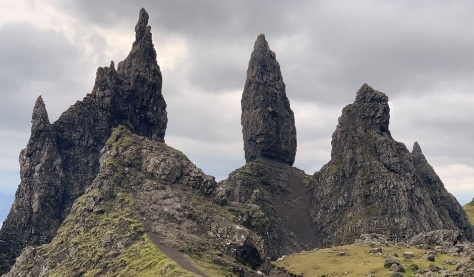
Old Man of Storr
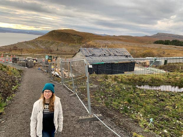
The next day we took the bus to the new carpark at the base of the Old Man of Storr. The Old Man is a rocky hill in the shadow of the Storr which is a plateau in the middle of the Trotternish peninsula.
The Old Man was apparently created from a rockfall from the Storr and is one of the most famous walks on the island. The carpark construction going on is an attempt to alleviate the street parking in the height of the summer.
We had checked out the bus time table and saw that we had three hours to get up and back which should not be a problem when the round trip was supposed to take two hours. Even with my low base fitness, we figured we should be alright.
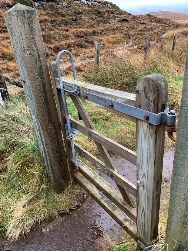
The early going was on good paths with an insistent gradient which allowed you to concentrate on the views without needing to pay much attention to your footing. The high fences and gates made sense as they were to keep deer out.
I never figured out whether the deer were in the uphill section and they were keeping away from the road below or being kept away from the heights above us.
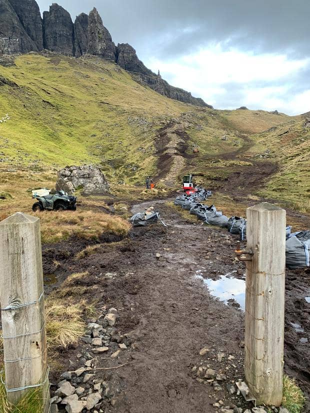
At the top of the section the path joined another, continuing up the hill over a slight rise into a dip. Any positive thoughts generated from the pause in uphill progress were stopped when we saw the what was ahead.
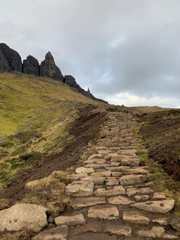
Some workers were creating a rock staircase up the side of the hill, the steepest parts already finished, with the flat parts between steps to be filled with aggregate later. At the bottom of the hill the path through the fence was in the process of being filled, a mechanical digger clearing the path for the bags of aggregate to be spread.
We inched around the digger which almost blocked the path and made good use of the steps. Having good solid rocks beneath us ensured we could concentrate on breathing rather than trying to figure out where to put our feet, so we made good progress again… until the steps ran out and the regular path was roped off to allow workers to create more stone steps.
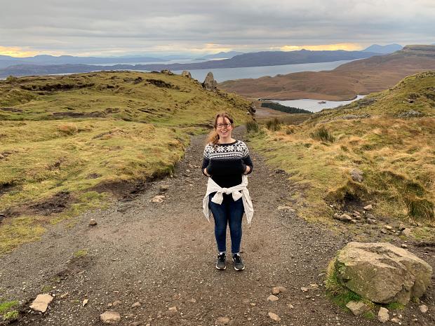
This meant we had to walk through less firm track churned up by previous track walkers. We did our best goat impressions and made our way back to where the track went and went along reasonably flat track to the base of the Old Man, checking out the other promontory stone structures.
We had made such good progress that Ange wanted to try and replicate the picture we’d seen in the hotel. I was more worried that we’d use up the extra hour buffer before the bus came, but went along.
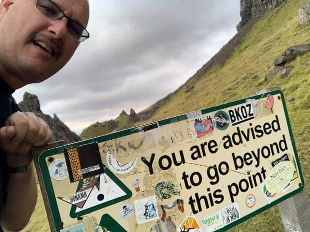
It was a little disconcerting coming across signs warning not to go any further… from the wrong side! In a couple of cases the “not” was scratched out, or covered in stickers. I couldn’t figure out which path you would have to have taken to come across the signs from the “proper” side, as we had taken the most obvious route up the hill.
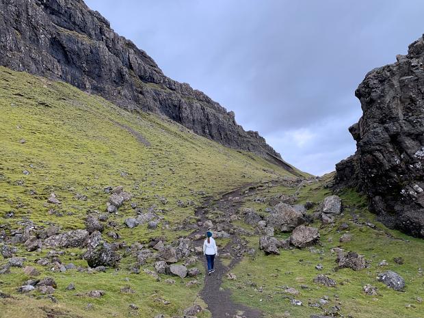
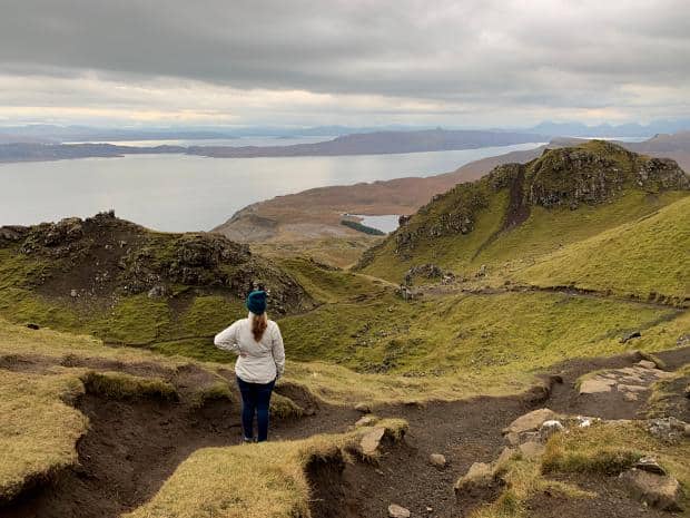
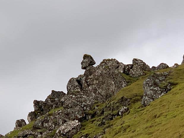
We paused for our lunch and then headed around behind the Old Man of Storr, marvelling at the fields of rock from the slide (the cause of the signs – if more rock came down there would be no warning!). The path behind the Old Man towards the Needle was straight from Middle Earth, and a welcome relief from the winds.
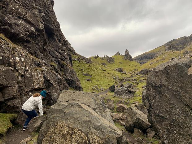
The path looped back around, narrow and exposed in parts, but firm enough underfoot. It was with some relief that we retraced our path and headed down the hill. Less strenuous than the route up, still needing to concentrate on path selection until we rejoined the staircase made of stone where the different muscles in our legs reminded us that they weren’t stretched on the way up.
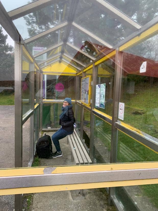
We reached the bottom with about twenty minutes to spare and then proceeded to look for the bus stop. Google Maps had it on the other side of the road about five minutes away so we headed there.
There was nothing at the spot it indicated, so I headed up a little further. Still nothing. I was worried – surely there would be something to show the bus stop? I looked at the printed out bus timetable and it had “Old Man of Storr Carpark” so we broke into a trot and made our way back to where we’d started from. Still no signage or anything. I figured I’d leap in front of the bus – surely that would stop him?
The darkening skies started to spit, delivering on their gloomy promise which had miraculously stayed dry up to that point. Around the corner came the bus, and I stuck out my arm and it pulled to a halt. As we got on board I asked the driver if this was a stop.
He responded that they operate a “Hail and Ride” system where you hail the bus and he would stop. As long as you were on the correct side of the road. Smiling in apology at catching the bus from the wrong side of the road, we made our way to our seats just as the rains really started in anger.
Happy that we’d made the bus and avoided a three hour wait to the next bus (we’d taken note of the phone number of a taxi driver as a back up so we wouldn’t really have to wait three hours in the rain), we headed back to Portree, only pausing briefly to see to a nasty blister on one of my toes from the walk down the hill.
Rain And Wind. And Rain. And More Wind.
We weren’t able to book a tour the next day, and the weather forecast looked dire. So we booked the tour for the next day instead and hunkered down in the room, watching squall after squall roll over the harbour from the hills beyond. The wind buffered the windows and the rain battered the panes all day and all night. Room service and a bath were the only antidotes!
Tour
Donald from Skye Scenic Tours picked us up and dropped us off after the winter tour – always a time efficient way of seeing a lot of the critical sights.
Carbost: Oyster Shed & Talisker Distillery
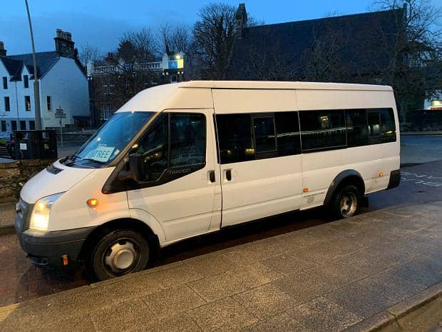
The sky was still threatening more rain when we caught the small local bus to Carbost. It was more a mini-van than bus, with three locals bestown with shopping from Co-op getting aboard without paying.
My face dropped when the driver said he only took cash, but this being Skye, the driver said he’d wait as I disappeared to the nearby bank to get cash out of the ATM. A return ticket purchased for each of us, we boarded. The driver asked if we were going to the distillery and we said that yes we would be, but after we’d gone to the Oyster Shed for lunch.
He said he’d drop us off just before the Shed at the top of the hill. We’d checked out the route on Google Street View and thanked him profusely for allowing us to avoid that climb, my legs at least still feeling the results of the trip up the Old Man of Storr.
This bus showed us a different side of life on the Island, the bus driver also delivering mail and helping the passengers on and off the bus with their grocery shopping.
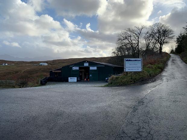
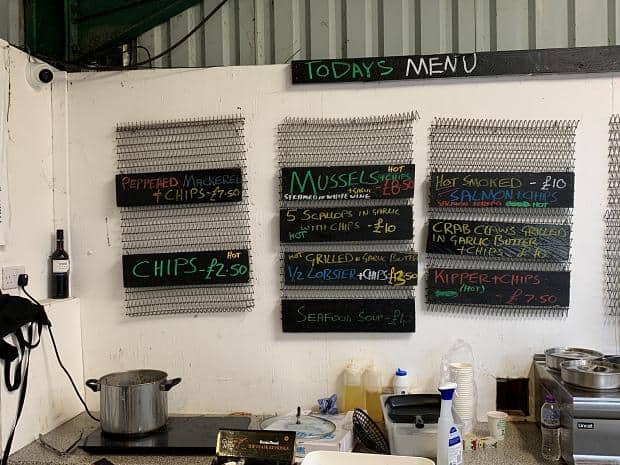
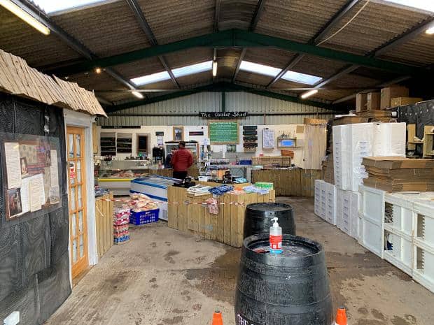
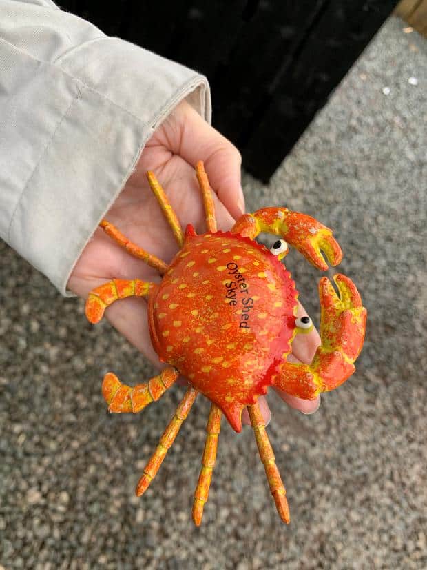
I think that the Oyster Shed is primarily a fish retailer with a kitchen bolted on. You order in the main part of the shop, surrounded by industrial levels of fresh fish of a wide array of assorted species. Ange was particularly enamoured by the crab fridge magnet with the legs which wobbled, only £2.50.
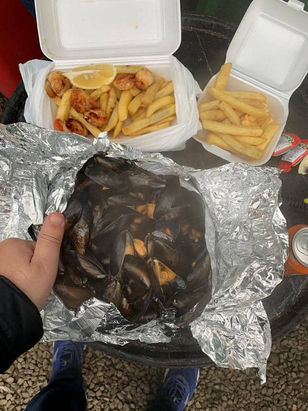
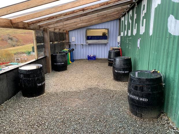
The volume of seafood you get at the Oyster Shed certainly lived up to what we’d seen online – definitely good value for money. The outdoor eating area is only partially roofed, so when the heavens opened I was thankful that Ange had chosen a good barrel to eat at.
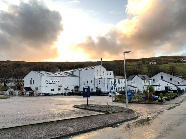
By the time we’d finished lunch the rain had blown over, and the walk back down the hill to the Talisker Distillery was a pleasant post meal meander. Though there was no footpath, so I had one ear cocked for traffic behind us.
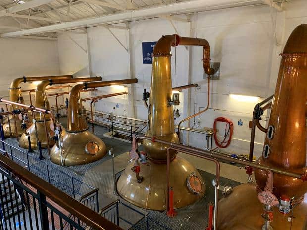
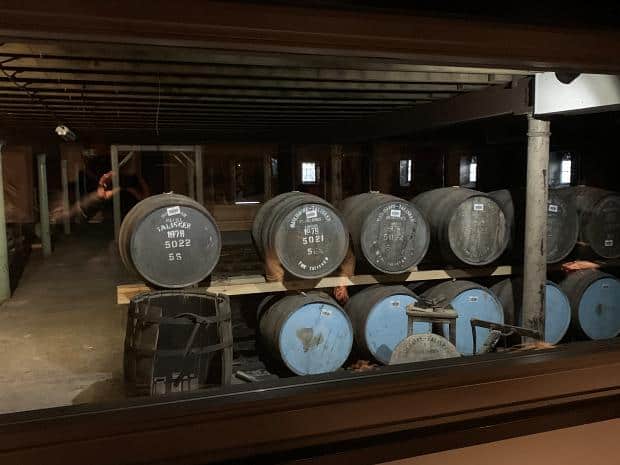
We’d booked our slot on the Talisker Distillery tour and we had a few minutes before it started so had a look around the exhibition.
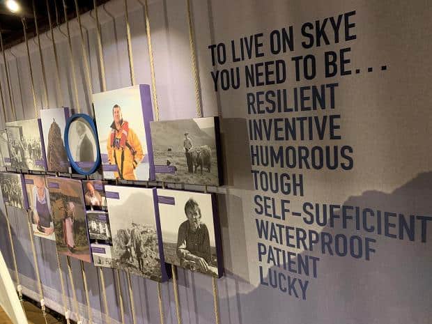
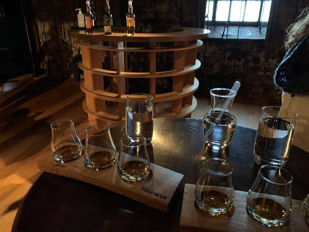
Megan did a good job with the tour, answering all our questions and walking through the tasting notes for the three varieties we tasted – the Talisker 10 Year, the Talisker Distiller’s Edition and the Talisker Distillery Exclusive.
Neither Ange nor I wanted to drink the full drams, so I made use of the “Drivers Option” which was a cool little hessian bag with little containers for the scotch, so that you could still have a taste in the Distillery but you could also take the rest home to enjoy there.
The only problem with a bus which only runs twice per day is that if you miss the last one you have an expensive taxi trip or an unexpected overnight stay. As a result we made sure we were at the bus stop in good time.
It also meant that we kept a beady eye on the road above Carbost, starting at each white van sighting, and only worrying a little when the bus was a few minutes late.
Dunvegan
We knew that Dunvegan Castle was closed, but there was walk which started in Dunvegan and went near the castle so we elected to take lunch and jump on yet an other bus to check out Dunvegan and the Two Churches Walk.
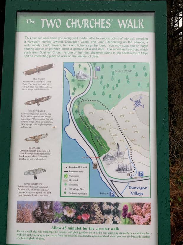
We got dropped off at Dunvegan village – the bus continued onto the Castle but that would cut the walk in half and spoil any sense of accomplishment. I did make a point of asking the driver where the return bus stop was.
Opposite the starting point of the walk, Ange found an alpaca wool store, selling knitwear as well as alpaca wool. We’d seen sheep throughout our tours and wanderings – the sheep pretty much left to their own devices, each spray painted a particular colour to indicate ownership, but hadn’t seen any alpacas. Ange bought some wool for her knitting, and then we headed back into the cold for our walk.
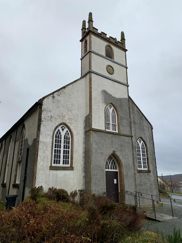
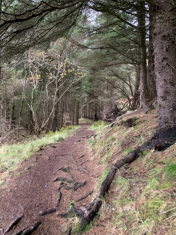
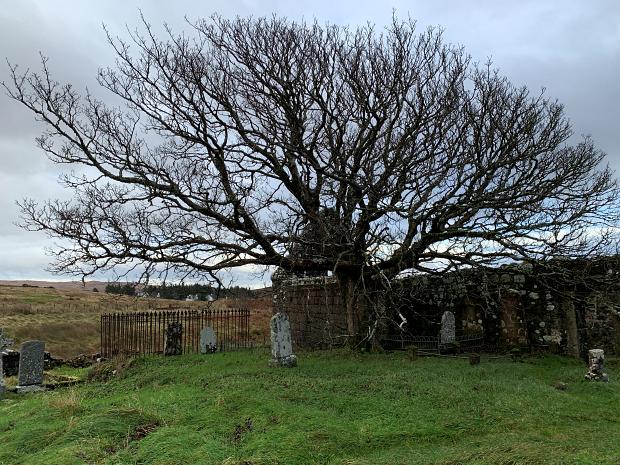
The two churches referred to by the walk title were the abandoned ruins of St Mary’s Church and the still-in-use Church of Scotland. The trail lead behind the church and along the hillside in the forest.
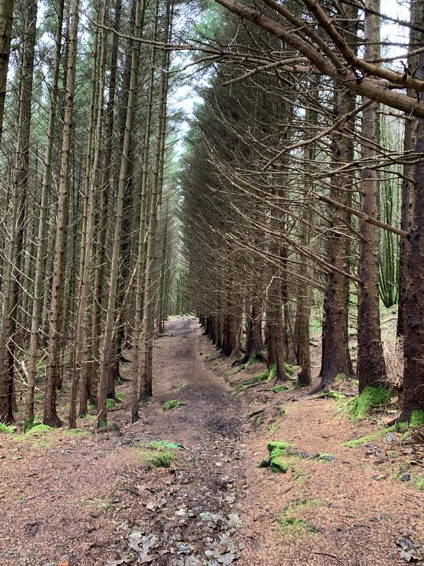
The trail was unusual for all the walks we’d done on Skye had been exposed and this one was under the canopy of a mature forest. It was unusual for another reason which became apparent as we proceeded.
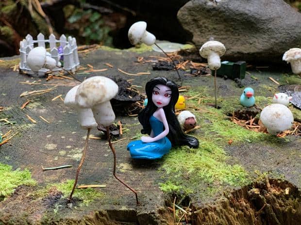
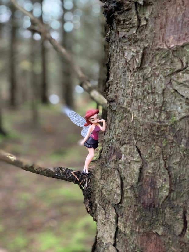
Periodically we came across “evidence” of fairies, obvious put in place by school children with named fairy doors either high on trunks or nestled in the roots of the trees along the path. There were also little fairy dolls stuck to branches
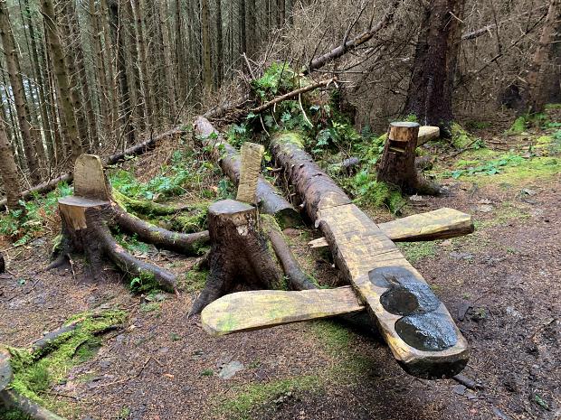
The path had little piles of logs alongside it in parts, and someone had cut a little picnic area into some of the logs, trunks being converted into seats and a log having seats spliced into it, looking almost like a seesaw, but surprisingly secure.
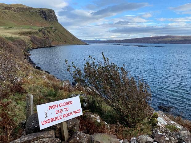
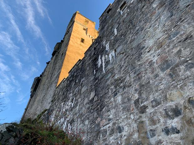
The path continued through the forest until stopping at a T intersection. The left hand side path lead to the main road and onto the Dunvegan Castle and Gardens. We headed to the gates just in case they were open, but no, the carpark was empty and the gates resolutely closed.
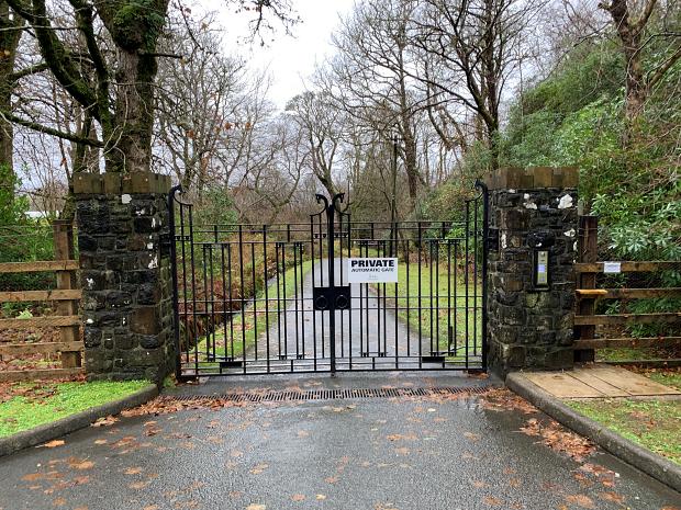
Just in the background beyond the closed and padlocked gates was the top of a tower from the castle. There were parts of the fence which we could have gotten over, but we thought it best to leave Skye by train rather than in a police van, so we headed back to where the path had split and continued on the official path.
The autumn leaves had left a carpet of dappled colour as the path started to climb to the top of the hill. It was slippery in parts and some areas had exposed rock, but it was all very low key after the various walks we’d already done.
Then we reached a gate which lead to more traditional environment: a track through gorse bushes, the canopy of forest gone now and, beyond the gorse, the brown of the bracken covering the hill sides all the way to the horizon.
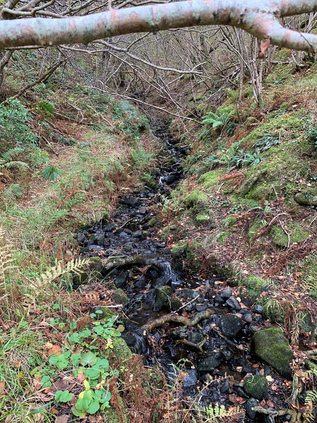
It wasn’t too long before the path itself seemed to be a stream, with limited footing which wasn’t actually under an inch or two of water. Deep enough to occasionally seep into your shoes and get your socks wet.
We braved our way through though and towards the end of the path we saw the side branch which took us to the Duirnish stone, a stone raised in the traditional method in 2000 to celebrate the millennium.
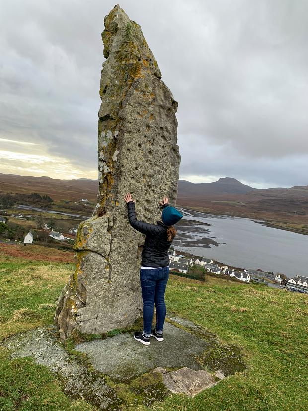
Ange checked out if the stone had any “Outlander” magic to take us back to 1743. We paused there for some lunch, sheltering out of the wind behind the stone. Then we headed down the hill to the other, ruined church, which turned out be the burial spot for the clan chiefs of the McLeods.
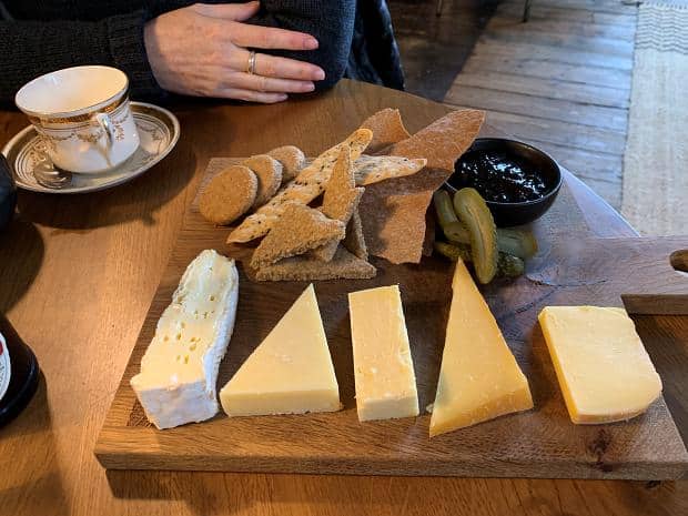
We still had over an hour before our return bus, so we walked through Dunvegan town and then back to the Dunvegan Inn for a tea or a coffee. They were full, but we waited outside and before long we were invited inside out of the cold and enjoyed a lovely cheese board.
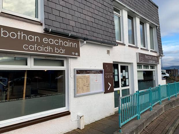
Eilean Donan Castle, Pock & Hector’s Bothy
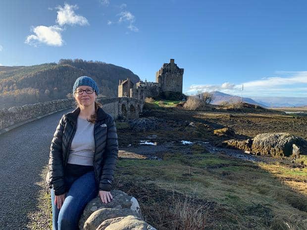
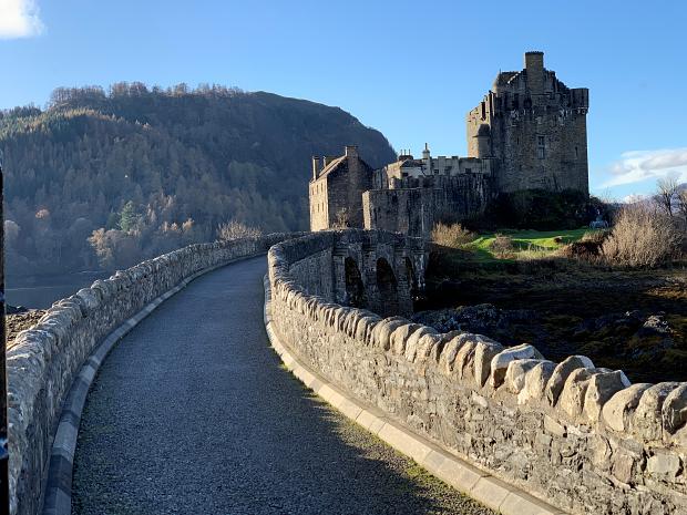
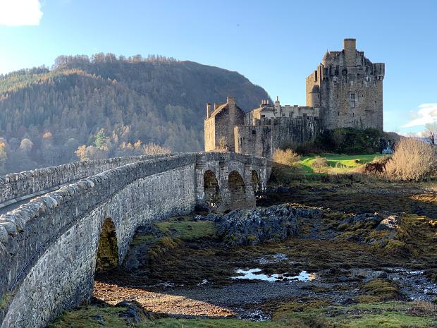
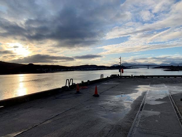
The next day was our last and so we took the bus back to Kyle. We’d arranged for a taxi driver to meet us to take us to Eilean Donan Castle, the most photographed castle in Scotland according to Brian McFadyen.
Brian was awesome: I thought we’d just get him to take us to the castle (which was closed), we’d take a few photos from the shore and then we’d go back to Kyle.
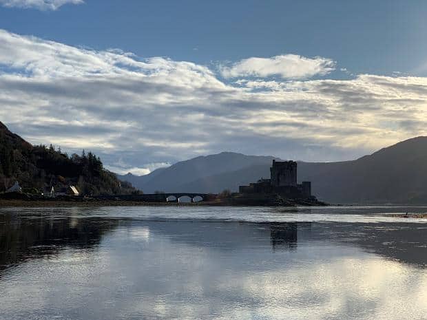
Instead, Brian dropped us off, told us he’d be back in half an hour, came back, took us to a vantage point across the loch, then took us to the starting point of a secret lookout. Finally he dropped our bags off at a café in Kyle so we wouldn’t have to carry them around to the lookout point. Great service, and great value.
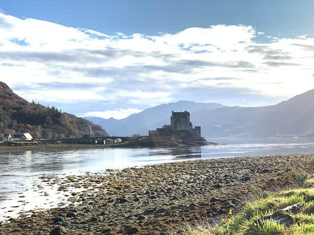
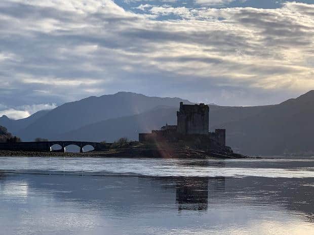
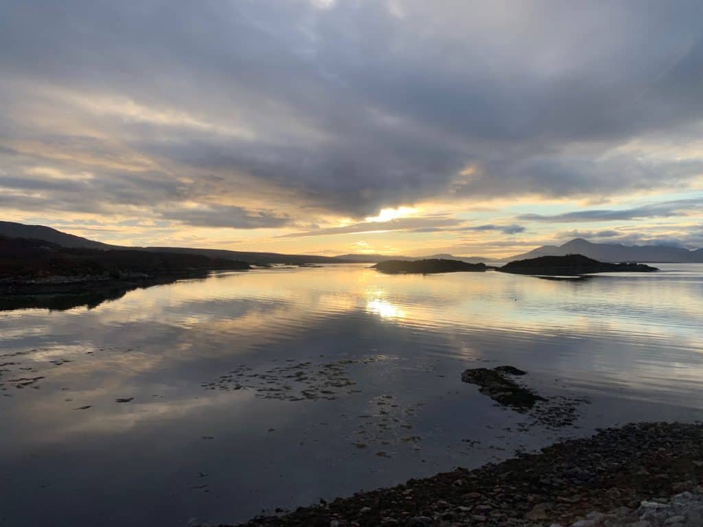
Eilean Donan Castle sits on an island where three lochs meet and has featured in many movies. It’s incredibly picturesque, and for Memorial day was lit up with red floodlights. It would have been something to see!
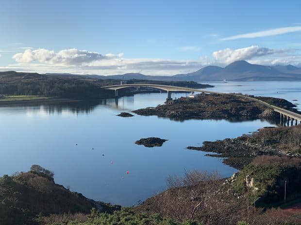
After commenting on the great weather, Brian took us to the secret lookout up the back of Kyle.
The lookout was reached out by a narrow lane which rose up from water level to a the top of a hill which commanded great views sweeping from Loch Alsh past Kyelakin to the Skye Bridge and around to Badicaul. Well worth the climb.

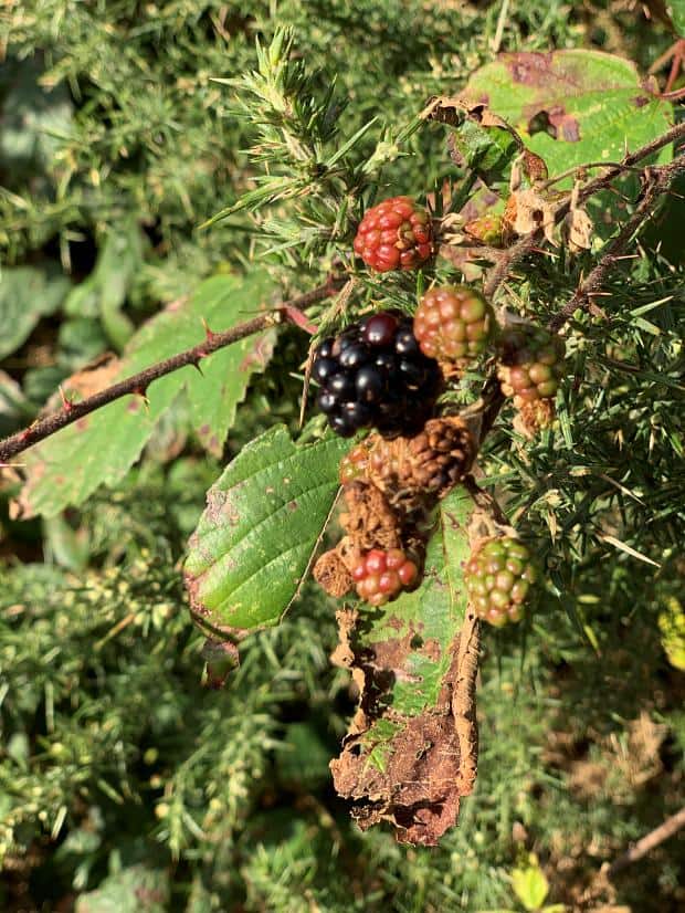
On the way down, Ange found some wild blackberries growing on the side of the road and tried one.
Then we headed to Hector’s Bothy to meet up with Brian and get our bags and to grab a bite before our train ride home.
On the way home we made sure that we sat on the left hand side of the train. Both Brian and the strange guy we’d talked to at the train station as we waited for the train had both given us that same piece of advice and it was true: the landscape reminded us of British Columbia in Canada in parts with the forest reaching down to the water line.
So we didn’t manage to get into Dunvegan Castle or see the Fairy Pools, but I guess it just gives us another reason to come back to Skye.