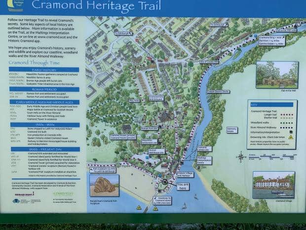
What can you do for free in Edinburgh? Well if you can get to Cramond on the coast, then a walk out to Cramond Island and then on to Lauriston Castle isn’t a bad way to spend a morning.
I’d first seen Cramond Island from the seat of an British Airways Airbus 319 as it came into land in Edinburgh Airport. The tide was in and I had no idea what the almost uniformly spaced paving stones were that were joining a teardrop-shaped island with the mainland.
They weren’t quite uniformly spaced, some were missing, the gap where they should have been standing out like a missing tooth in an otherwise perfect smile. And such a straight line – obviously man made, but how would anyone be able to leap from stone to stone? It made no sense.
The mystery was solved when Ange suggested we head over for a half day trip.
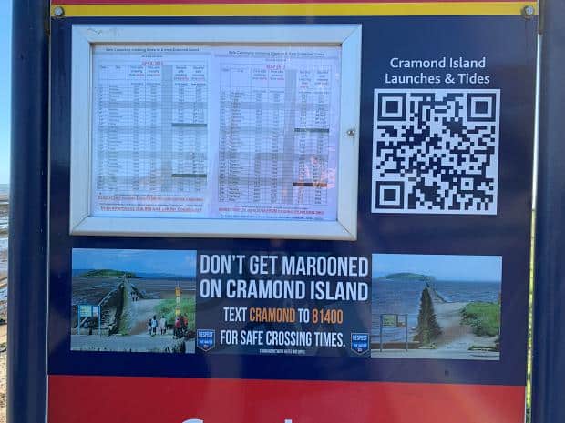
Ange mentioned that the causeway out to the island was covered most of the time by the tidal waters of the the Forth River, and so we pored over the tidal charts to make sure we would be abel to get there and back in time.
Our research kept turning up newspaper articles about people getting stuck on the other side – not so bad but an eight hour wait for the tide to change and not a lot to do on the other side except apportion blame and recriminate. One hapless party even called out the Life Guard to take them back across.
The only justification I could think of for calling out the emergency services would be if I was in risk of missing a flight but even then I would be mortified wasting their time like that. So we made very sure we had plenty of time to get there and back.
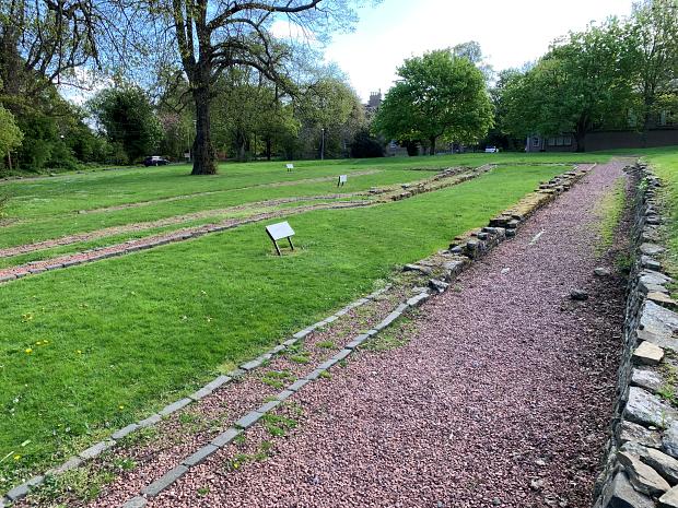
The No. 41 bus took us to the top of the hill overlooking the township of Cramond and a brief downhill stroll took us past the ruins of the old Roman village (which we resolved to investigate on our way back up) and to the park where the causeway started.
A stern warning on a poster admonished walkers to check the tide chart to make sure that they had time to make it there and back and listed the tides for the next two months. It was chilly due to a blustery wind ripping in off the water but the sun was out giving a modicum of spring warmth.
A few hardy souls were out in walking their dogs or exercising but this early in the morning there weren’t that many people around.
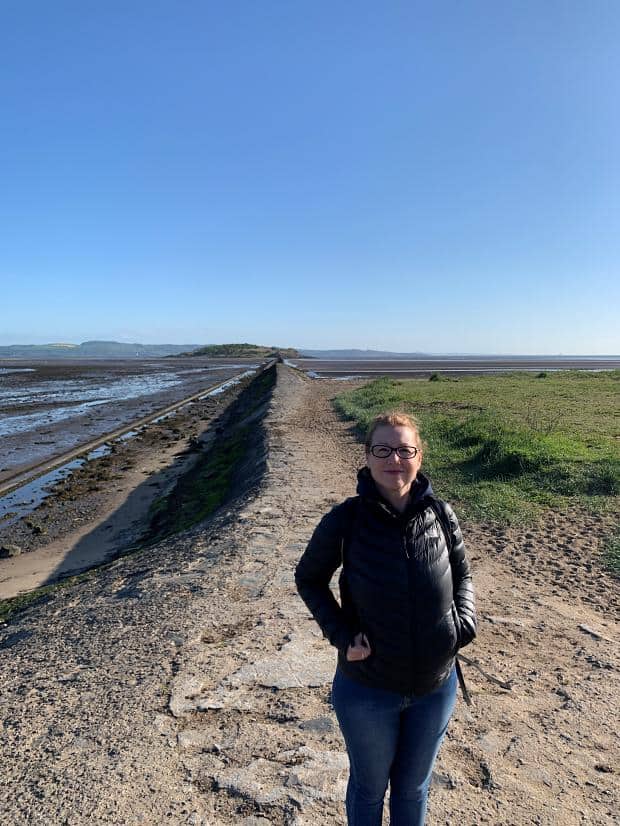
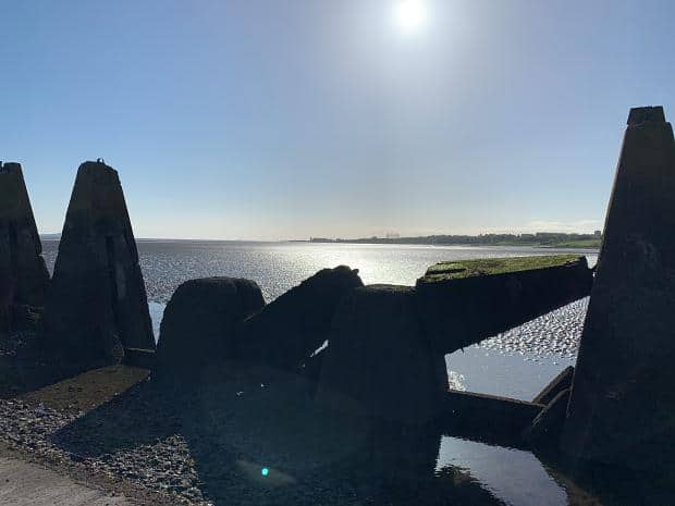
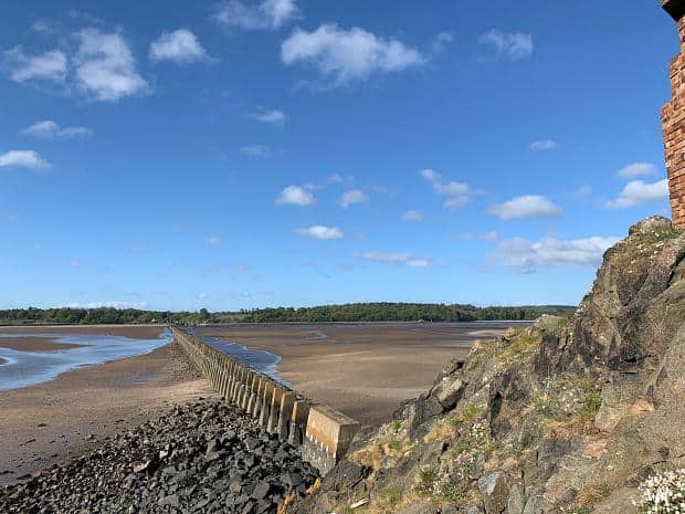
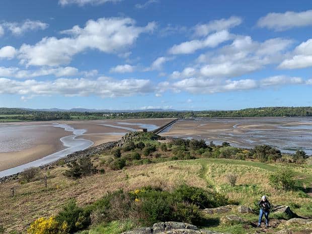
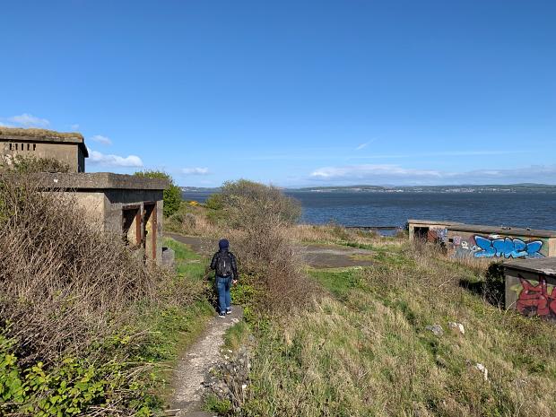
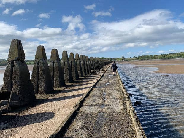
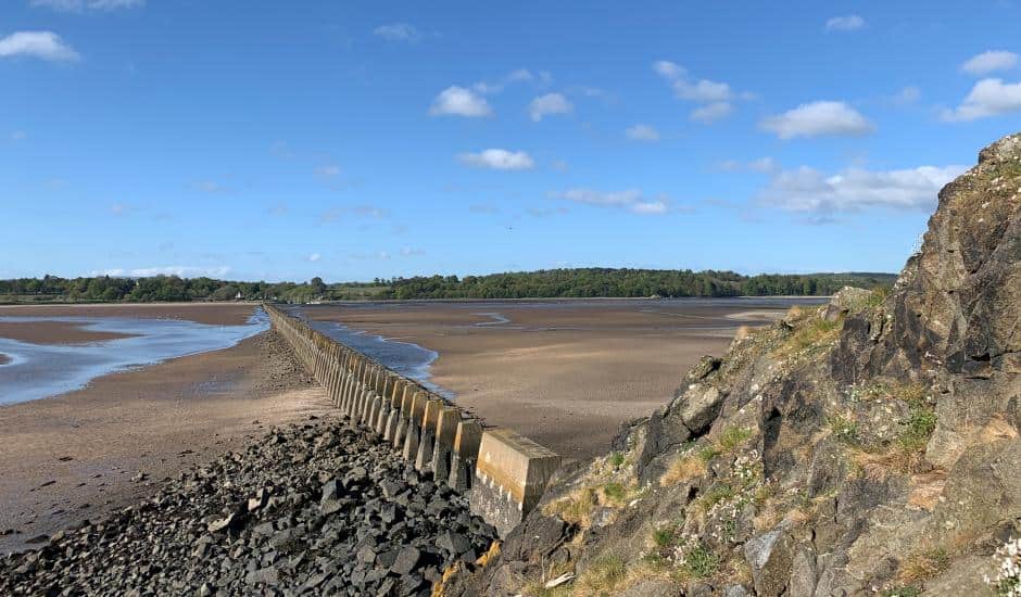
The causeway started off as a path alongside an embankment and after about 100 metres (I found out later it was 135 metres or ~150 yards) the embankment gave way to the teeth of concrete. The tops of these were the stepping stones I had seen from the air – the only part of the causeway visible at that time of the tide.
Some of the teeth had fallen, hence the gaps, and all of them were far too far away from each other to be used to hop out to the island, even if they had all been there.
Once the path was submerged you really would be stuck over there. The beach stretched off into the distance in both directions, the long flat beaches of the UK we’d discovered in Cornwall with our surf lesson which meant that the tide moved incredibly quickly – very easy to misjudge the amount of time remaining.
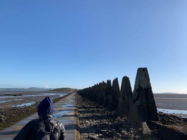
We made our way along the path in the shadow of the concrete teeth, most still sporting the iron loops at their top showing how they had been lowered into place back during the Second World War.
Most of our research had mentioned that the teeth were there as an anti-submarine protections for the island but I frowned when Ange repeated this to me.
I’m no expert on submarines but my recollection was that they would need much deeper water to get around the island, so it couldn’t be for that. Ange dug deeper and discovered that writers were confused – the teeth stopped surface craft from sneaking around the defenses on the island, ensuring that the spotlights and guns, plus the anti submarine net stretching across the Firth could protect the harbour shipping and docks further up river.
It was funny to me that writers would confuse a submarine net going across the river with the concrete teeth, but I guess growing up in Auckland with a similar submarine net protecting Auckland Harbour during WW2 gave me a bit more of an understanding.
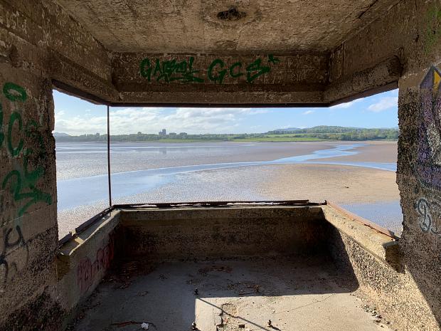
Out on the causeway the wind got quite blustery and we were glad when we finally made our way into the observation post looking back towards Cramond.
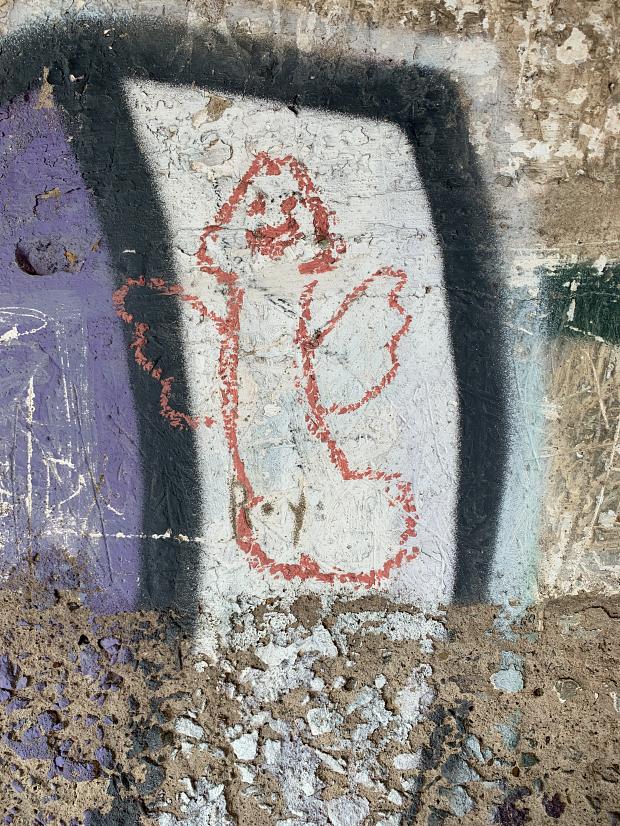
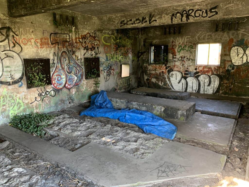
Graffiti of the expected level of sophistication plastered the concrete bunker walls: one bunker pointing along the causeway while the other faced the seaward direction. We enjoyed a brief rest before heading out to explore the rest of the island.
The island isn’t huge (½ km or ⅓ mile long) and so exploring wasn’t too taxing.
First we climbed the hill right in the middle of the island. The usual signage which would explain all the surrounding landmarks had either rotted away or been vandalized leaving just the stumps in the ground which was disappointing.
The path continued north through the underbrush and popped us out beside a building. I couldn’t figure it out – it had windows but not ones which would have supported weapons and it was all two rooms which again didn’t support a gun emplacement.
The floor was concrete and the rooms were large meaning that it wasn’t an observation post and the sturdiness of the floor and the patterns of the concrete floor suggested support for something heavy. We found out later that this was a generator room for power for the spotlights which illuminated the Forth during wartime.
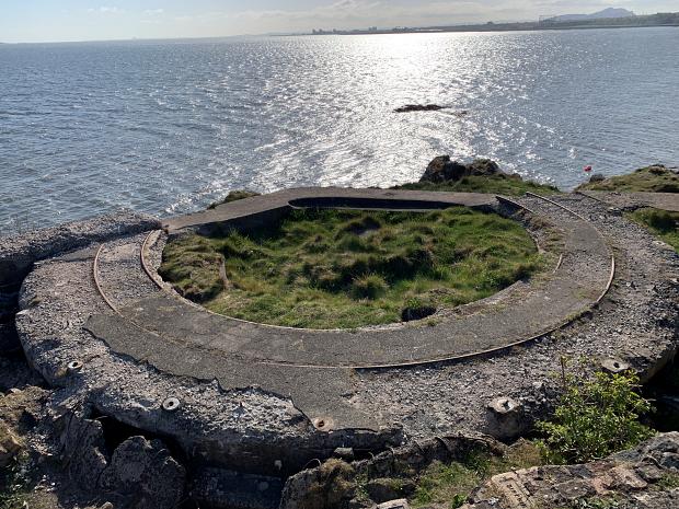
On we went further north and then, on the beach, we found a scattered double handful of bunkers, all facing over the river, and an obvious gun emplacement with the rail on which it would swivel still showing rusting away embedded in thick concrete.
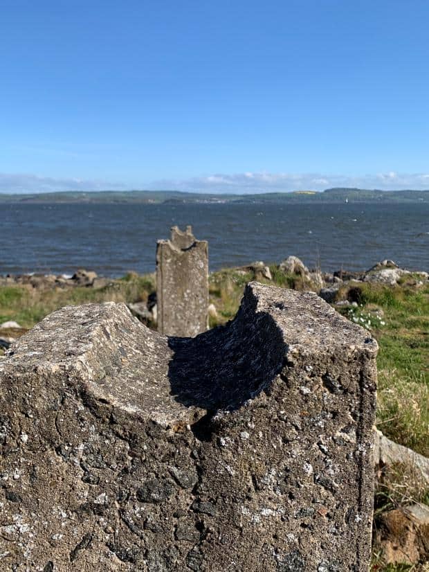
Nestled in among the bunkers were a number of concrete stands with semi circular grooves in the top of them lined up like gun sights facing the water. Obviously where a cable from the submarine net would have come ashore and held tight against the tides.
We had a look around, finding another hut with the same concrete patterned floor before picking our way past the yellow flowered gorse bushes and back along the edge of the beach back towards the causeway.
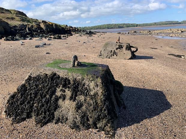
On the way back to the causeway we came across the ruins of some red brick buildings, of an obviously different era from the WW2 bunkers and nearby were some more concrete blocks with iron hooks in the top.
Ange observed deadpan that they probably hadn’t been washed up onto the beach in a storm. We suspected that they were some sort of mooring for boats coming over before the causeway was built – apparently there had been oyster beds on the island.
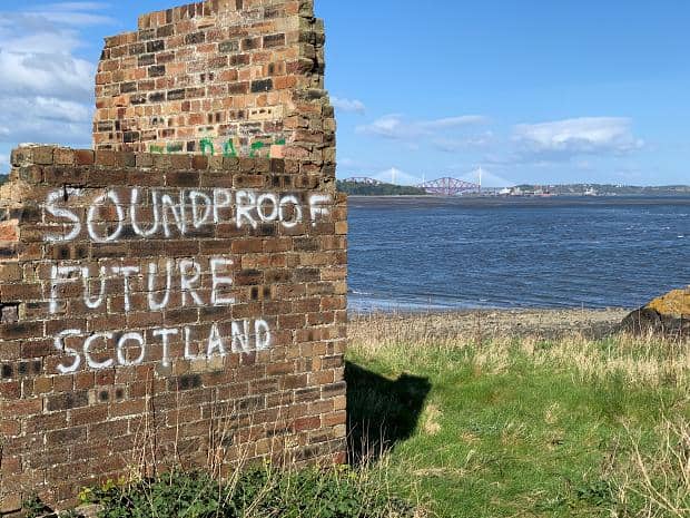
From here we could see up the river to the docks and shipyards which would have been protected by this island. In the distance a big red cantilevered bridge spanned across the width of the river, 361 ft (110 m) above the water.
Ange already knew that it was the Firth of Forth Bridge, but I told her that two bridges had previously stood there (which wasn’t true, but set up my joke). Which means that it’s the Third Firth of Forth Bridge, I continued. She rolled her eyes.
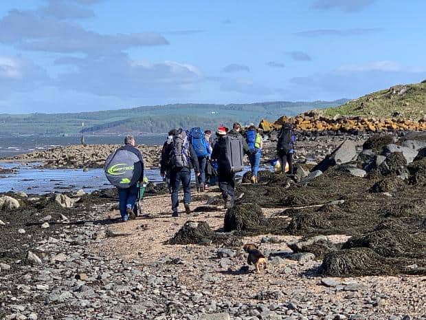
On the way back to the causeway along the beach we saw a group of people walking the other way. Obviously planning to stay over night, they had packs and sleeping bags, while the last of them was pushing a wheelbarrow with a large container of water.
The group was predominantly male and half older and half younger – obviously either Scouts or a school group. They were chatting happily amongst themselves and trailed by a Jack Russell but I wondered what they would actually do on the island. Tell ghost stories?
Anyway, we managed to get back across the causeway with a bare two hours to spare (lol), and briefly paused for some dried mango chips before heading back up the hill, this time stopping off at the various historic markers on the way.
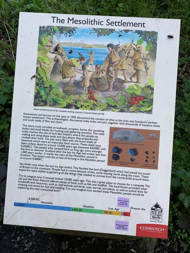
The first was an indication that Cramond had been a settlement for Mesolithic peoples back 10,000 years ago but there obviously wasn’t too much left of that!
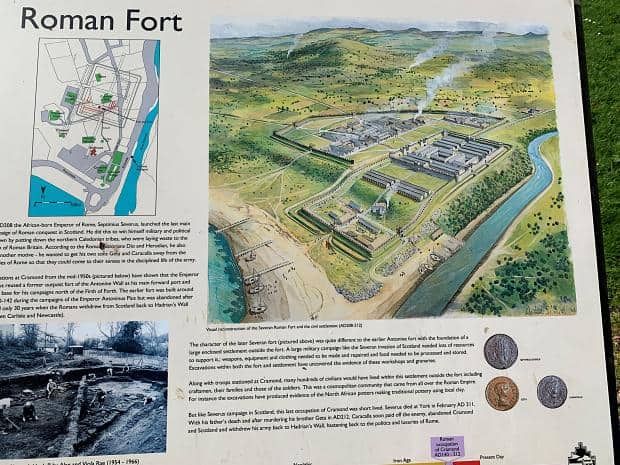
The next were rocks laid out where the foundations and walls of the Roman settlement were, part of the Antonine Wall which represented the northern extent of the Empire.
My dark sense of humour was tickled with the story on the board. A Roman emperor sent his two sons to the wall to get them away from the political intrigues of the court and for them to come to their senses in the disciplined and austere life in the army. Upon the emperors death one of the sons promptly slayed the other and returned to the luxuries of Rome to become Emperor. Families!
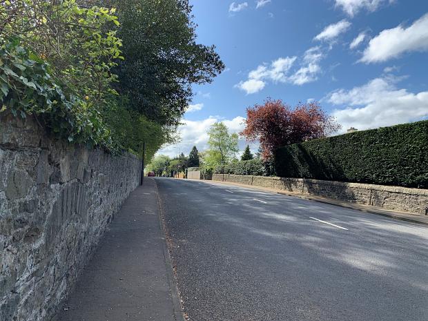
And that was about it in Cramond. While the sun was out, the 1.7 mile (2.7km) walk to Lauriston Castle wasn’t particularly interesting save for a stretch alongside some nice farmland, so the 40 minute walk was a bit of a boring interlude between Cramond Island and the castle.
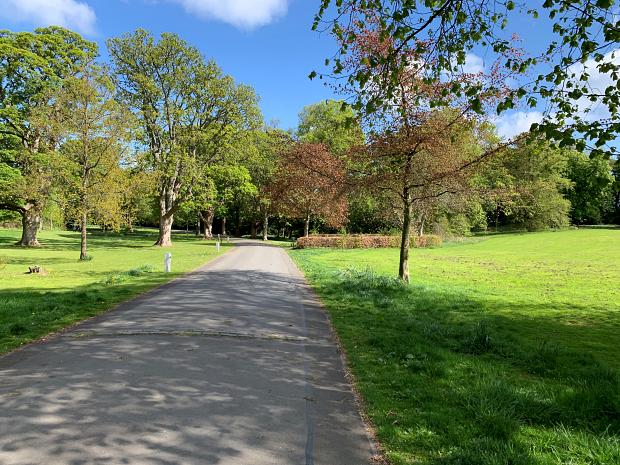
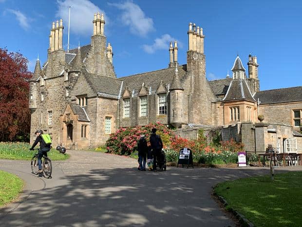
The path actually passed the alongside the grounds of the castle and if I’d been in an energetic mood I would have suggested we jump the fence to shorten the journey, but instead we trod on. The entrance was through the carpark and the well manicured grounds.
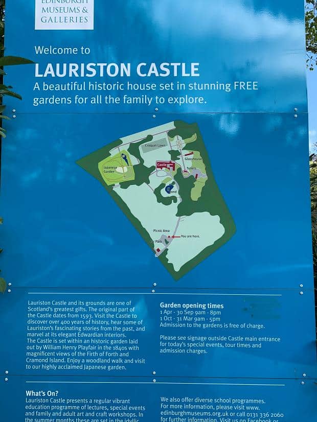
The castle turned out to be an Edwardian Residence and while we could have paid less than £10 to enter, it really didn’t look like it would warrant the fee.
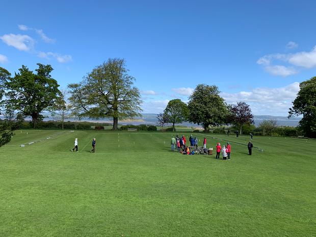
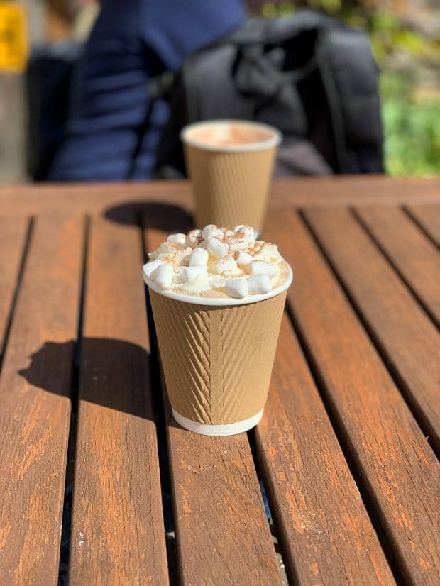
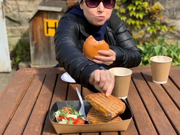
We did a circuit of the exterior and saw that the grounds behind the castle were immaculately presented and had been converted into croquet pitches with a number of parka’d parties playing the game with views out over the river. We elected to spend our money on a hot chocolate (mine with marshmallows and whipped cream) and a bite to eat at the cafe at the entrance.
The walls of the courtyard blocked the wind and the sun shone brightly down making the dining experience quite bearable after the buffeting on the road and on the island and causeway.
Afterwards we strolled down into Lauriston township and caught the bus back to Edinburgh. I think if I did it again I would be inclined to take the bus from Cramond to Lauriston, just because the 40 minute walk didn’t really add anything – except maybe a little more to the appetite for the snack at the castle!
But the causeway out to the island was cool – a very different experience and a sniff of danger with the tides, while solving the mystery for me of the stepping stones seen from the plane.